Wildfire conditions can change fast. When you notice smoke, strong winds, or an alert from a neighbor, knowing where to check reliable fire information quickly can help you decide whether to monitor the situation or leave early. This guide breaks down the most trusted maps and tools, how to interpret fire perimeters, and why alerts matter more than any single website. Always evacuate immediately if authorities issue an order. Maps are helpful, but they don’t replace official guidance.
Below, you’ll find a 30-second quick check, a deeper look at the best wildfire tools, and clear steps for staying informed when you search “is there a fire near me?”
Table of Contents
- TL;DR: Fast Check
- Best Tools for Accurate Fire Information
- “Are There Fires Near Me?” Search Phrases That Work
- How to Read Fire Maps
- Alerts You Should Enable
- When to Act vs When to Monitor
- Last-Resort Refuges and Where a FORT Fits
- FAQs
- Key Takeaways
- Conclusion
Quick Answer: How to Check “Is There a Fire Near Me?” in 30 Seconds
If you need the fastest possible answer, start here:
-
Open your state’s official incident page:
- Check your county emergency map or GIS viewer
(Note: Examples appear below; every county publishes its own evacuation zones and road closures.) -
Verify with a secondary real-time tool:
- If you see smoke but no fire is showing on maps, assume a delay.
Prepare to leave and turn on local alerts.
Maps lag. Evacuation orders never do. Follow authorities first.
Best Tools for Accurate, Real-Time Fire Information
Fire maps vary in purpose. Some track official incidents, others show evacuation zones, and others highlight smoke or heat detections. Using at least two tools together gives you the most accurate picture.
CAL FIRE Incident Map (California)
CAL FIRE publishes official incident data for California, including perimeters, acreage, containment, and assigned resources. Updates occur when incident commanders release new information.
Strengths:
- Most accurate for CAL FIRE-managed incidents
- Shows containment progress
- Includes official incident fact sheets
Limitations:
- Does not show every small fire immediately
- Perimeters may lag during fast-moving conditions
See our guide on reading California wildfire maps.
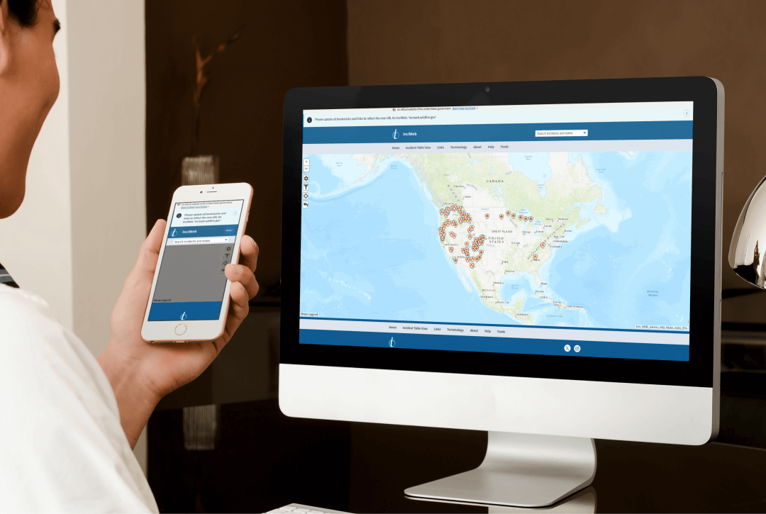
InciWeb (Nationwide Federal Incidents)
InciWeb is maintained by the U.S. Forest Service and is best for fires on federal lands—national forests, Bureau of Land Management areas, national parks, and multi-state incidents.
Strengths:
- Excellent for wilderness, remote, and large-scale fires
- Includes closures, photos, press releases, and updates
Limitations:
- Updates depend on incident team staffing
- Some state or county-level fires may not appear
NIFC National Fire Maps (U.S.)
The National Interagency Fire Center publishes daily fire activity summaries, large incident maps, and national situation reports.
Strengths:
- Best for understanding regional or national wildfire activity
- Helpful when traveling
Limitations:
- Not ideal for neighborhood-level decision-making
County GIS & Local Emergency Maps
County emergency departments and sheriff’s offices update evacuation zones and road closures faster than any national tool.
Examples:
Why these matter:
County agencies publish evacuation warnings, orders, shelters, and road closures long before they appear on statewide maps.
Supplemental Tools
Watch Duty
Crowdsourced reports from trained volunteers, scanners, and fire watchers.
AirNow Fire & Smoke Map
Shows smoke plumes, air quality, and fire detections.
PurpleAir
Hyperlocal air quality sensors—helpful for “what’s burning near me” when you smell smoke.
Windy Fire Layer
Useful for seeing wind direction, smoke transport, and forecast changes.
“Are There Fires Near Me?
Fire Map Search Phrases That Actually Work
Search engines interpret different phrases differently. These variations surface broader or more specific information:
- is there a fire near me
- are there fires near me
- what’s burning near me right now
- is there a forest fire near me today
- is there a fire burning near me
Why Variations Produce Different Results
- “Near me” queries rely on location permissions on mobile. If location access is blocked, results will be less accurate or default to a broader area.
- Some terms trigger news results, while others highlight maps or official incident summaries. For example, “wildfire near me” often surfaces recent news stories and social posts, while “fire map [county]” tends to surface official GIS and incident maps.
- Adding your county (e.g., “fire map Sonoma County”) improves accuracy dramatically. County names focus results on local emergency pages, evacuation zones, and sheriff updates.
Best Search Phrases for Speed
- For incident status: fire map [your county]
- For smoke : smoke map near me
- For breaking news: wildfire near me + your county sheriff
How to Read Fire Maps
Perimeters, Heat Detections & Update Times
To avoid misinterpretation, here’s how the main map layers work.
Fire Perimeters
Perimeters represent the outer boundary of the area that has already burned. They do not show flame location in real time.
Key notes:
- Perimeters may be updated only a few times per day.
- During wind-driven events, perimeters often lag reality.
MODIS / VIIRS Satellite Heat Detections
Satellite detections show possible heat signatures. They are useful, but not precise.
Limits to understand:
- Detections can show false positives (sunlit rocks, industrial heat).
- Timelines can be delayed by hours due to satellite pass frequency.
- They do not show where crews are working or where flames are visible.
Use satellite detections as a complement, not a primary source.
Update Times & Latency
Even the best maps have delays because incident commanders must confirm details before publishing updates.
This is why no fire on the map does NOT equal no threat.
Cross-check multiple tools, especially during red flag conditions when small ignitions can grow quickly.
Evacuation Zones & Road Closures
These layers are often more important than the fire’s exact size or perimeter when deciding whether to leave.
County GIS updates commonly publish:
- Evacuation warnings
- Evacuation orders
- Road closures
- Shelters
- Re-entry guidance
Always follow your county’s system first.
Alerts You Should Enable
Staying informed is as important as monitoring maps.
Wireless Emergency Alerts (WEA)
Enabled by default on most phones, but worth confirming in your device settings. WEA can deliver evacuation orders even if cell towers are strained or mobile data is slow.
County Text & Email Alerts
Every county has its own alerting platform. Examples include:
Sign up for your home county and any county you regularly commute through.
National Weather Service Red Flag Warnings
Red Flag Warnings indicate extreme fire behavior potential—often the days when a small ignition can become a fast-moving threat.
When to Act vs When to Monitor
Understanding when to leave versus when to stay alert is essential.
Leave or prepare to leave when:
- Your county issues an evacuation warning
- Fire conditions worsen quickly
- You see smoke and winds increase
- Your primary evacuation route is at risk
Reminder: Maps support awareness. Evacuation orders override everything.
Last-Resort Refuges: Where a FORT Fits
In rare, last-resort situations when evacuation isn’t possible, a purpose-built, tested wildfire refuge like the FORT™ can provide temporary protection. Always evacuate if you can. A FORT is a backstop, not a replacement for evacuation, defensible space, or a family wildfire safety plan.
Learn more:
FAQs
1. How do I know if there’s a fire near me right now?
Check your county’s emergency map first, then confirm with CAL FIRE, InciWeb, or NIFC depending on your region. If you see smoke but maps show nothing, assume a delay and prepare to leave early.
2. Why do maps show no fire, but I smell or see smoke?
Smoke often travels miles from its source. Maps can also lag during rapidly changing conditions. Use AirNow to verify smoke origins and turn on local alerts.
3. What’s the most accurate website for checking wildfires near me?
There is no single perfect source. CAL FIRE (California), InciWeb (nationwide), and your county GIS viewer together provide the most accurate picture.
4. Are satellite heat detections reliable?
They’re helpful indicators but not exact. MODIS/VIIRS heat spots can be delayed, misaligned, or triggered by non-fire heat sources. Always verify with official updates.
5. How often do wildfire maps update?
Some update every 15 minutes (smoke maps); others only when incident teams release new data. County evacuation maps update the fastest.
6. Where can I get evacuation information if maps are delayed?
Your county emergency alert system and sheriff’s office provide the earliest authoritative updates. Sign up for text or email alerts for your specific county.
7. Is there an app that alerts me if a fire is near my home?
Many people use Watch Duty, PulsePoint, and their county alert apps. None replace official alerts, but they add situational awareness.
8. When should I evacuate if a fire is near me?
If an evacuation warning is issued or conditions deteriorate—leave early. Don’t wait for a mandatory order during high-wind or nighttime fire conditions. Early action saves lives.
Key Takeaways
- Start with official sources—CAL FIRE, InciWeb, NIFC—and confirm with your county’s emergency map.
- Fire perimeters lag; evacuation zone maps update faster.
- Satellite heat detections are helpful but imperfect.
- Alerts matter more than any map.
- If you see smoke or receive an evacuation warning, prepare to leave early.
- A FORT™ is a last-resort refuge only. Evacuation is always the safest option.
Conclusion
Staying informed during wildfire season starts with fast, reliable information. Using a combination of official incident maps, county evacuation tools, and timely alerts helps you make the safest choices when conditions shift. Bookmark the tools that serve your region, set up your alerts now, and build your go-bag so you can act quickly when needed.
In rare, last-resort situations when evacuation is impossible, a tested refuge like the FORT™ can provide temporary protection—but evacuation always comes first.
Learn more about how the FORT™ fits into a responsible, evacuation-first wildfire plan here.
Configure your FORT™