Wildfires don’t have to be burning nearby to create real risk. For homeowners, estate teams, and anyone living in the wildland–urban interface, the biggest advantage you can have is time — time to harden the home, reduce fuels, organize evacuation plans, and document your mitigation before an insurer asks questions. That’s where a wildfire risk map helps.
Unlike live incident maps, which show active fires and emergency conditions, a wildfire risk map estimates longer-term exposure based on fuels, terrain, historical fire patterns, and weather and climate trends. Used correctly, it is a planning tool — a way to prioritize what to do next. It is not a safety guarantee, and it should never override official alerts or evacuation orders.
In Short
A wildfire risk map shows how likely wildfire could affect an area or property over time, not whether a fire is currently threatening it. Address-level tools are most useful for homeowners because they highlight property-specific vulnerabilities and help prioritize mitigation. ZIP code and regional maps provide broader context but can mask neighborhood-level differences. Risk maps are most effective when paired with live fire and smoke tools, which show what is happening right now, such as active fire maps and wildfire smoke and air quality tools. If your risk score is high, the most important next step is action — reducing vulnerabilities and strengthening evacuation readiness well before fire season peaks.
Table of Contents
- What a Wildfire Risk Map Measures (and What It Doesn’t)
- Best Wildfire Risk Maps by Use Case (Address-Level vs Regional)
- Wildfire Risk Map by Zip Code & Risk Score by Address: How to Read Results
- “Wildfire Risk Map Near Me / USA / Today”: Links & Caveats
- Pair Risk with Live Incidents & Smoke Tools
- Turn a Risk Score into an Action Plan (Home Hardening + Zone 0)
- Document Your Mitigation for Insurance
- California Risk Tools (Standalone Section)
- Last-Resort Planning: Where the FORT™ Fits (and limits)
- FAQs
- Key Takeaways
- Conclusion
What a Wildfire Risk Map Measures
When people first search “wildfire risk map,” they’re often trying to answer two different questions at once: How exposed is my home over the long run? and Do I need to worry right now? A risk map is designed for the first question — long-term exposure — and it becomes most useful when you treat it like a planning dashboard.
Most wildfire risk models draw from combinations of:
- Fuels and vegetation (how much burnable material exists, and how it typically behaves)
- Topography (slope, aspect, and terrain that can speed up fire spread)
- Historical fire patterns (where fires have occurred and how they’ve moved)
- Weather and climate trends (heat, drought, wind patterns, and season length)
- Development patterns (how close structures are to wildland fuels)
Just as important is what many risk maps don’t show:
- Active fire perimeters or containment
- Evacuation orders
- On-the-ground firefighting activity
- Real-time wind shifts that can rapidly change conditions
That’s why a wildfire risk map should be thought of as a pre-season tool. It helps you decide where to focus time and money. When a fire is active, you pivot to real-time sources and official alerts.
Best Wildfire Risk Maps by Use Case
There isn’t one perfect wildfire risk map. The best choice depends on what you’re trying to do. If you’re talking to an insurer, planning mitigation projects, or managing a high-value property, you’ll want an address-level view. If you’re comparing regions or trying to understand broader exposure across a county or state, regional tools can help.
Address-Level Tools (Best for Property Decisions)
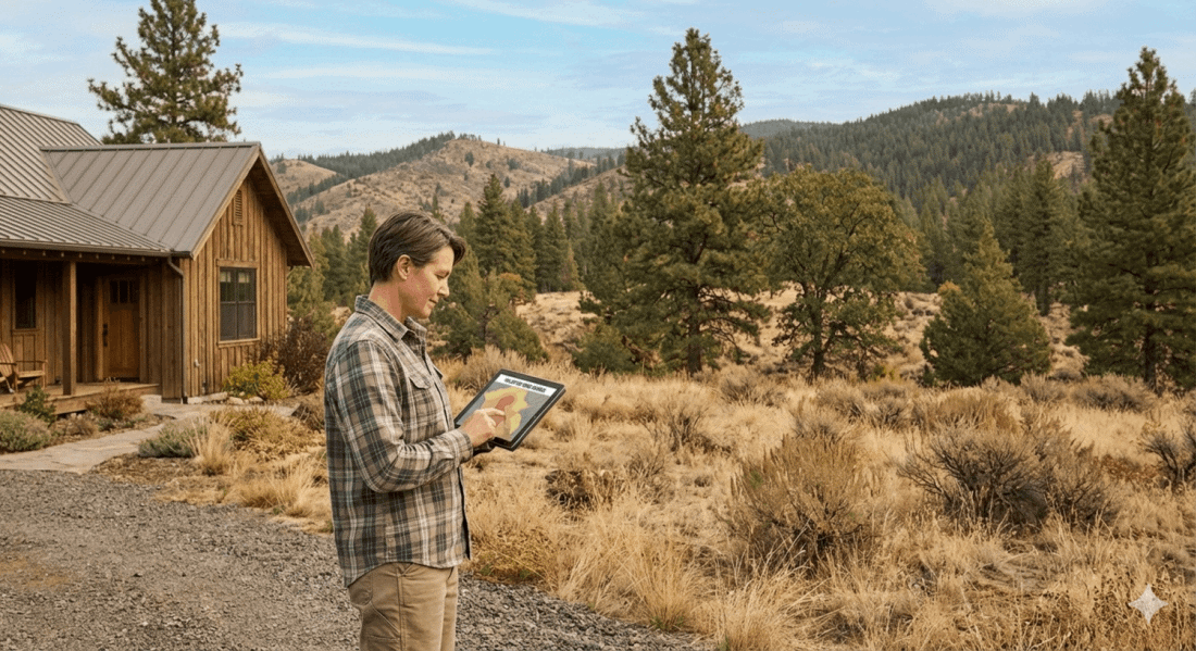
Address-level tools are designed to answer a practical question: What does wildfire risk look like for this specific property? They’re typically the most actionable because they encourage clear next steps such as mitigation, documentation, and upgrades.
They are especially useful for:
- Prioritizing home hardening projects (vents, roofs, decks, and Zone 0)
- Planning defensible space work over the season
- Supporting insurance conversations with a clear mitigation plan
- Helping estate managers track risk across multiple structures
What you’ll commonly see in address-level tools includes:
- A numeric score, percentile, or rating band (low to extreme)
- Factors that drive risk, such as fuels, slope, or ember exposure
- A defined time horizon (for example, “expected risk over a certain number of years”)
Tip: If an address-level tool provides a breakdown of contributing factors, save or print it. This information can help you clearly explain why certain upgrades or mitigation steps were prioritized, whether for your household, an estate owner, or an insurer.
Address-Level and Community-Level Wildfire Risk Maps
- Wildfire Risk to Communities (U.S. Forest Service)
An interactive map from the United States Forest Service that allows users to explore wildfire risk by community, county, tribal area, or state, including housing exposure and overall wildfire likelihood. Explore the map. - Southern Wildfire Risk Explorer
A regional wildfire risk map covering much of the southeastern United States, with address and community-level views that highlight wildfire exposure, fuels, and landscape conditions. View the Southern Wildfire Risk Explorer. - Northeast–Midwest Wildfire Risk Assessment
An interactive wildfire risk map for the northeastern and midwestern United States that allows users to search by address or community and explore local wildfire risk factors. Open the risk map.
ZIP Code, City, County, or State Tools (Best for Context)
Regional wildfire risk maps are helpful for broad awareness and comparisons. They are often used by people who are moving into a new area, managing multiple properties, or trying to understand how risk varies across larger regions.
They are useful for:
- Comparing risk across counties or states, including “wildfire risk map USA” searches
- Getting a general sense of where higher-risk corridors are located
- Supporting travel planning and seasonal awareness
However, they also have important limitations:
- ZIP code boundaries can include very different terrain and vegetation types
- An “average risk” score can hide the fact that a specific neighborhood or street is more exposed
- They usually aren’t detailed enough to indicate what should be fixed on a specific home
Regional and National Wildfire Risk Maps
- Federal Emergency Management Agency (FEMA) National Risk Index
A national map that includes wildfire risk alongside other natural hazards, allowing users to compare relative wildfire risk across counties and census tracts. View the National Risk Index map. - Wildfire Hazard Potential Map (U.S. Forest Service Research)
A national dataset that classifies wildfire hazard potential based on fuels and landscape conditions. This map is best used for understanding regional wildfire hazard rather than property-specific risk. View wildfire hazard potential.
If you only have time to use one type of tool, start with address-level maps, then use regional tools to provide additional context. These tools work best when layered together. Regional and national maps help you understand where wildfire risk is concentrated, while address-level and community maps help you identify what to prioritize at the property scale. For current conditions, always pair risk maps with live fire and smoke tools.
Wildfire Risk Map by Zip Code & Risk Score by Address: How to Read Results
A wildfire risk score can feel deceptively simple: one number, one label, one color. In reality, wildfire risk is layered, and reading the results well requires understanding what the score is actually trying to represent.
Here are several ways to approach a risk score without over-interpreting it.
1) Treat the score as a prioritization tool.
If your score is high, it’s not a prediction that your home will burn this year. Instead, it’s a strong signal to take action, such as:
- Reducing immediate fuels near the structure, starting with Zone 0 (the first five feet)
- Hardening the home against ember intrusion
- Building a faster, clearer evacuation plan
2) Expect variation between platforms.
Two tools may rate the same address differently because they rely on different:
- Data sources
- Modeling assumptions
- Time horizons
- Definitions of “risk” (such as probability, hazard, vulnerability, or a combination)
The most practical approach is to look for consistent themes. If multiple tools point to fuels, slope, or ember exposure as key drivers, those areas are often the best place to focus first.
3) Don’t let “moderate” create complacency.
“Moderate risk” often translates to “wildfire is a plausible threat.” Preparation is still warranted, particularly in areas that regularly experience red flag warnings, heavy fuels, or recurring smoke impacts.
4) Use ZIP code tools as a starting point, not a final answer.
A wildfire risk map by ZIP code can be helpful for scanning broad exposure, but it cannot capture micro-conditions such as:
- A canyon that funnels wind
- Dense vegetation immediately behind one neighborhood
- A ridge line that behaves differently under fire weather conditions
When making mitigation decisions, it’s best to move from ZIP code context to address-level tools and then to an on-property assessment.
“Wildfire Risk Map Near Me" - What to Search
Search behavior says a lot about intent. When someone types “wildfire risk map near me,” they are usually looking for something local and immediate. “USA” often signals comparison across regions. “Today” typically reflects concern about current conditions — which is where people most often reach for the wrong type of tool.
“Near me”
Location-based tools can be useful, but they also require care:
- Device location can place you in the wrong ZIP code or jurisdiction
- Rural addresses may map imprecisely
- Some tools default to regional data when address-level detail is expected
When possible, enter a full street address or nearby cross streets and confirm that the map pin is accurate.
“USA”
National wildfire risk maps are helpful for broad context, especially for:
- Multi-property owners
- Estate managers overseeing sites in different regions
- Relocation or long-term planning
Use these tools to understand where risk concentrates, then zoom down to address-level maps for decisions.
“Today”
This is the most important caveat. A wildfire risk map generally does not mean “danger today.” It will not tell you:
- If a fire is currently burning nearby
- Whether evacuations are underway
- Where smoke may move tonight
For “today” questions, you need live incident and smoke tools.
Pair Risk with Live Incidents & Smoke Tools
If wildfire risk maps represent the planning layer, live tools provide situational awareness. Most households need both. A high risk score matters year-round, but real-time conditions determine what actions are appropriate on a given day.
Use these Wildfire Safety Systems resources to build a reliable real-time stack:
- Live fire maps and guidance on how to read them: Is There a Fire Near Me? Understanding Fire Maps
- Smoke and air quality index guidance and tools: US Wildfire Smoke Map: Best Tools to Track Smoke & Air Quality Index
A simple habit that helps: if you see smoke, smell smoke, or notice ash, check smoke and air quality conditions first, then confirm live incidents and local alerts. During fast-moving events, official alerts should guide decisions — not a long-term risk score.
Turn a Risk Score into an Action Plan
A wildfire risk score only becomes useful when it changes what you do next. The goal isn’t to “solve” wildfire risk — it’s to reduce the ways embers and flames can impact your home and to make leaving early easier if conditions deteriorate.
Start with Zone 0 (0–5 feet)
Zone 0 refers to the first five feet immediately surrounding a structure. This area is the most vulnerable to ember ignition, and it is often the most manageable place to start. Small changes here can significantly reduce risk.
Common Zone 0 priorities include:
- Clearing leaves, pine needles, and debris that accumulate against exterior walls
- Moving mulch, wood piles, and other combustible storage away from the structure
- Keeping the immediate perimeter around the home simple, clean, and noncombustible
Strengthen the Home Against Embers
Wind-driven embers are responsible for many home ignitions during wildfires. The specific improvements that make sense depend on the structure, but several areas consistently deserve attention.
Common focus areas include:
- Vents and other exterior openings
- Roof edges, valleys, and gutters where debris can collect
- Decks and the area underneath them
- Gaps and corners where leaves and embers tend to accumulate
Expand Defensible Space Outward
Once Zone 0 is addressed, defensible space work can move outward in phases so it remains realistic and sustainable over time.
- Reduce ladder fuels that allow fire to climb from the ground into tree canopies
- Create spacing between shrubs and trees to limit continuous fuel
- Keep driveways, paths, and access routes clear for people and emergency responders
Evacuation Planning Is Still the Foundation
Even with strong mitigation in place, evacuation planning remains the core safety strategy. Preparation should make leaving earlier and more smoothly possible, not harder.
- Identify at least two evacuation routes
- Prepare go-bags in advance
- Set clear household roles for pets, important documents, vehicles, and communication
If you need a simple next step, choose one Zone 0 task and one evacuation task to complete this week. Momentum matters more than perfection.
Document Your Mitigation for Insurance
Insurance conversations are changing quickly in many wildfire-prone areas. Whether you are renewing a policy, shopping for coverage, or simply trying to stay prepared, it helps to keep mitigation work organized and easy to document.
A simple mitigation documentation kit often includes:
- Dated photos showing before-and-after conditions for Zone 0 and defensible space work
- Receipts for upgrades such as vent improvements, roof repairs, or vegetation clearing services
- A one-page log describing what work was done and when
- A short seasonal checklist that tracks routine maintenance like gutter cleaning and debris removal
This documentation does more than support insurance discussions. It helps households and estate teams stay consistent year to year and creates clarity when responsibilities are shared across staff, vendors, or multiple family members.
California Risk Tools
California readers often want state-specific context because terminology, agency roles, and mapping tools can differ from other states. California also has a strong ecosystem of county-level maps that residents rely on during fire season, especially when conditions change quickly.
If you’re in California, add these to your toolkit:
- CAL FIRE resources for statewide fire information and readiness guidance, including the official incidents map and preparedness materials: CAL FIRE Incidents and Ready for Wildfire. The fire hazard severity zones maps are particularly helpful for insurability information.
- County GIS maps for local layers such as parcel context, evacuation zones, and road closures. Start by searching your county emergency management or GIS page (for example, “<County Name> CA evacuation map” or “<County Name> CA GIS fire map”) and bookmark the official portal you find.
- Community Wildfire Protection Plans (CWPPs) and local mitigation planning resources, often hosted by counties, Fire Safe Councils, or state/federal partners. A good starting point for community-level planning and defensible space guidance is the NFPA Firewise USA program.
Even in California, the same rule holds: risk tools help you plan, while live tools and official alerts guide what you do during an incident.
Last-Resort Planning: Where the FORT™ Fits
In rare, last-resort situations when evacuation isn’t possible, a purpose-built, tested refuge like FORT™ can provide temporary protection. Always evacuate if you can; a FORT™ is a backstop, not a substitute for evacuation.
That framing matters because the safest wildfire outcome is leaving early. A last-resort refuge is considered only for the narrow scenario where routes close and residents are fully trapped. It should sit inside a broader readiness plan — defensible space, home hardening, evacuation routes, alerts, and training.
If you’re evaluating last-resort options, start here:
FAQs
What is a good wildfire risk score?
There isn’t a single “good” score because tools use different scales and time horizons. In general, lower risk ratings indicate less modeled exposure, but they don’t eliminate the need to prepare. Use the score to prioritize mitigation work and update your evacuation plan.
What does wildfire risk mean?
Wildfire risk describes the likelihood that wildfire could affect a location over time based on fuels, terrain, and weather and climate patterns. It’s meant for planning, not for real-time decisions during an incident.
What is a wildfire warning on maps?
A wildfire warning usually refers to active conditions such as red flag warnings, evacuation notices, or emergency alerts. Those are different from long-term risk scores and should always take priority when making decisions.
How do I know my wildfire risk score?
Start with an address-level wildfire risk tool if you want property-specific insight, then compare it with regional context for your county or state. After that, validate the “why” with an on-property review of Zone 0 (the first five feet around the structure), vents, rooflines, and defensible space.
Key Takeaways
- Risk scores are starting points. Use them to decide what to fix first, not to decide whether you’re “safe.”
- Different maps can disagree. That’s normal because models use different inputs and time horizons.
- “Today” searches need real-time sources. Risk maps don’t track evacuation orders, perimeters, or smoke conditions.
- Documentation matters. Photos, receipts, and a simple mitigation log can support insurance conversations.
- Evacuation planning is always the foundation. Everything else supports leaving early and safely.
Conclusion
A wildfire risk map can be a powerful tool — not because it predicts the future, but because it helps you prepare earlier and make smarter choices. When you understand your risk score by address or ZIP code, you can focus on the upgrades and maintenance that matter most, create a cleaner evacuation plan, and keep documentation that supports long-term resilience.
The most effective approach is layered: use risk maps for planning, pair them with live incident and smoke tools for situational awareness, and act quickly when conditions change. If a fire threatens your area, follow official guidance and evacuate early.