Table of Contents
- What Is Fire Weather?
- How to Read a Fire Weather Forecast
- What Triggers a Red Flag Warning
- Which Winds Drive the Worst Fire Days
- How Fire Behaves When the Weather Turns
- What You Can Control Before the Next Red Flag Day
- Which Tools and Maps to Watch
- How to Run the Monitor, Prepare, Evacuate Sequence
- Where the FORT Fits on a Dangerous Fire Weather Day
- Frequently Asked Questions
- Key Takeaways
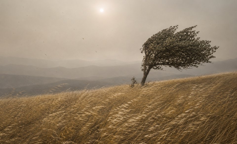
The hillside behind the house has looked the same for a decade. Same oaks, same dry grass, same fence line. On most September afternoons a fire that started there would creep through the grass and a crew would put it out by dinner. On a handful of afternoons each year, the same fire in the same grass runs a mile before anyone finishes calling it in. Nothing about the hillside changed. The weather did.
That difference has a name. Fire weather is the set of conditions that decides whether a spark stays a spark or becomes something nobody can stop. If you live in or near fire-prone terrain, learning to read it is the highest-value hour you'll spend on wildfire preparedness, because it's the only part of the problem that tells you what's coming before it arrives. This guide covers what fire weather is, how forecasters measure it, which winds produce the worst days, and what to do when the forecast turns.
Read it with one thing settled up front: evacuation is always the safest choice, and the reason to watch the weather is to leave early, while leaving is still easy. Understanding fire weather buys you time. Time is the only thing that reliably keeps people safe, and every hour you gain by watching the forecast is an hour you don't have to spend making decisions on a road you can't see.
In Short
Fire weather is the combination of low humidity, strong wind, dry fuel, and unstable air that lets a new fire spread fast. The National Weather Service issues a Red Flag Warning when those conditions are happening or about to. Criteria vary by region, so the numbers that matter are the ones your local forecast office publishes for your fire weather zone, not a national threshold. On any dangerous fire weather day, leaving early is the safest thing you can do.
Reading the weather is one layer of a wildfire plan that also includes hardening the house, keeping defensible space and breaks maintained, and having a written evacuation plan the household has actually read. For the case where evacuation becomes impossible, an on-site refuge like the FORT® is designed to work alongside that planning as part of a layered wildfire protection plan. If you have the FORT, a Red Flag Warning is also your cue to start moving valuables into it, whether or not you end up leaving.
What Is Fire Weather?
Fire weather is any combination of weather conditions that makes wildfire ignition and rapid spread more likely. Forecasters watch four things: how dry the air is, how hard the wind blows, how dry the vegetation has become, and how stable the atmosphere is above the ground. Wildfire weather is the same term used loosely. When all four line up badly on the same afternoon, a fire that would normally stay small doesn't.
Three time scales shape one dangerous fire day

How dry air pulls moisture out of fuel
Dry air actively dries out vegetation, hour by hour, on the day of the fire. Relative humidity is the measure, and the number that matters is the afternoon minimum rather than the daily average. Humidity typically bottoms out in mid to late afternoon and recovers overnight, which is why so many fires make their biggest runs between 2 p.m. and sunset. Grass and pine needles respond to a humidity drop within an hour or two. When afternoon humidity falls into the teens, fine fuels are ready to carry fire the moment something ignites them.
How wind feeds and steers a fire
Wind does three separate jobs, and each one makes a fire worse. It supplies oxygen to the flame front, so the fire burns hotter. It tilts the flames forward into unburned fuel, so the fire preheats its own next meal and moves faster. And it carries burning embers out ahead of the fire, starting new fires downwind. Sustained wind speed tells you how fast a fire will push. Gusts tell you how unpredictable it will be, and gusts are what turn a flank into a new head.
What "cured fuel" means, and why drought sits underneath everything
Cured fuel is vegetation that has lost most of its living moisture and now behaves like kindling. Annual grasses cure on a schedule: green in spring, gold and fully cured by mid-summer in most of California. Larger fuels take much longer, which is where drought comes in. A single dry winter leaves brush and timber measurably drier going into the next fire season, and several dry years in a row leave heavy fuels dry enough to carry fire in conditions that wouldn't have supported it before. Drought isn't a daily variable you check. It's the background condition that sets how bad any given day can get.
Why unstable air makes a bad day worse
Unstable air lets a fire build its own weather. When the atmosphere above a fire is unstable, the smoke column rises fast and tall instead of flattening out, and that rising column pulls air in at the surface from every direction. The result is erratic surface winds near the fire that have nothing to do with the forecast wind, plus embers lofted high enough to travel a long way before they land. Forecasters track this with stability indices. Homeowners mostly encounter it as the reason a fire's behavior can change without the wind forecast changing.
How to Read a Fire Weather Forecast
A useful fire weather forecast comes down to two numbers and one sentence. The numbers are the afternoon minimum relative humidity and the sustained wind with gusts. The sentence is whatever hazard language your local National Weather Service office has attached to the day. Everything else is refinement.
The two numbers to look for
Look for afternoon minimum relative humidity and sustained wind with gust values, in that order. A real example makes the pairing concrete. On 21 August 2026, the NWS office in Medford issued a Red Flag Warning for fire weather zone 624, covering the Klamath Basin and the Fremont-Winema National Forest. The specifics: south to southwest wind at 15 to 20 mph with gusts to 25 to 30, and minimum humidity around 12 to 18 percent. Those two lines are the whole picture. Wind that keeps a fire moving, humidity low enough that fine fuels ignite on contact.
Treat those figures as one zone's criteria on one day. They are not a national threshold, and the next section explains why.
What ERC and FWI actually are
ERC and FWI are fire-danger indices built for agencies, not for homeowners. ERC stands for Energy Release Component, part of the US National Fire Danger Rating System. It expresses how much heat energy is available per square foot in the flaming front of a fire, which in practice makes it an index of how dry the entire fuel bed has become over weeks and months rather than a forecast of today's weather. A high ERC means the landscape is loaded. FWI stands for Fire Weather Index, the summary number produced by the Canadian system, which rolls six separate components covering fuel moisture and spread rate into a single value.
Here's the honest part. Both indices exist so that agencies can decide where to pre-position crews, aircraft, and equipment across a region. Neither is published as a number next to your address, and neither answers the question a homeowner is actually asking, which is whether today is the day to load the car. If you're curious about the underlying system, the US version formerly called NFDRS2016 is now NFDRSv4.
The Haines Index, briefly
The Haines Index is a 2-to-6 scale describing how unstable and how dry the lower atmosphere is. A 6 means conditions aloft favor large, erratic fire growth. It's a genuinely useful number for fire behavior analysts. You will almost never need it, and if a day is bad enough for the Haines Index to matter, your local forecast will already say so in plain language.
What to read instead
Read your local forecast office's hazard language and the national Fire Weather Outlook risk categories. The Storm Prediction Center publishes those outlooks for Day 1, Day 2, and Days 3 through 8, and it sorts wind-and-humidity risk into three words: Elevated, Critical, and Extreme. A separate layer flags dry thunderstorms, which start fires with lightning and no rain to follow. Three words and a map do more for a household decision than any index value, because they're already the product of a forecaster weighing all four ingredients for your region.
What Triggers a Red Flag Warning
A Red Flag Warning is issued when the National Weather Service determines that weather conditions favoring rapid fire spread are happening now or beginning soon. The NWS is direct about what the warning is not: it "does not mean there is a fire." It means the conditions are in place for one to run if it starts.
The criteria change by region, and that's deliberate
Red Flag criteria are set locally, not nationally. Each NWS forecast office defines the wind and humidity thresholds that constitute critical fire weather for each of its own fire weather zones, based on the fuels, terrain, and normal climate there. A 20 mph wind with 15 percent humidity is an ordinary summer afternoon in parts of the Great Basin and a serious event in coastal Sonoma County. Both offices are right, because they're describing different landscapes.
This is the most misunderstood thing about the product, and it has a practical consequence: a threshold you read in an article written for somewhere else tells you very little. Find the criteria your own forecast office uses.
Watch versus Warning
A Fire Weather Watch means critical fire weather conditions are possible during the watch window, usually a day or more out. A Red Flag Warning means those conditions are occurring or will begin shortly. A watch often upgrades to a warning as the forecast firms up, and it sometimes doesn't. Treat a watch as the cue to look at your plan and a warning as the cue to act on it. Our companion guide covers what a Red Flag Warning is and how to prepare for one in more detail.
Fire weather zones are not county lines
The warning polygon on the map follows fire weather zones, which are drawn around fuel types and terrain rather than political boundaries. Your county can be split across two zones with different criteria and different warnings in effect, and a warning can cover the ridge above your house without covering your address. Check the zone, not the county.
A Red Flag Warning is a weather alert. It is never an evacuation order. Evacuation orders come from local fire and law enforcement agencies, and when one arrives, leaving immediately is the only correct response.
Red Flag Warning Actions
Which Winds Drive the Worst Fire Days
California's worst fire days are offshore wind days. Air moves from the interior toward the coast instead of the usual direction, and on the way it does something that makes everything worse. These events have regional names, and if you live where they happen, they're the days worth planning your year around.
How a downslope wind dries and accelerates
Air descending a mountain range compresses, warms, and loses relative humidity as it falls. That's the whole mechanism, and it's why an offshore wind event is categorically different from a windy day. The air arriving at your property didn't come from over the ocean carrying moisture. It came down off a range, gaining several degrees and shedding humidity with every thousand feet of descent, then accelerated through whatever canyon or pass funneled it. Meteorologists call the general pattern a foehn wind. What reaches the ground is hot, dry, and fast.
Santa Ana winds
Santa Ana winds are Southern California's offshore event, driven by high pressure over the Great Basin pushing air toward the coast. They accelerate through the canyons and passes of the Transverse and Peninsular ranges, and they're most common from autumn into winter, which is precisely when Southern California fuels are at their driest and the rains haven't arrived. Most of Southern California's largest and fastest fires happened during Santa Ana conditions.
Diablo winds
Diablo winds are the Northern California version, named for the Diablo range east of San Francisco Bay. The setup is high pressure over Nevada against lower pressure along the central California coast, and the wind descends through the East Bay and North Bay hills. Gusts in these events can exceed 60 mph. Napa, Sonoma, and the ridgelines around them sit directly in the path.
Why offshore wind events run all night
Offshore wind events don't calm down after dark, and that catches people out. An ordinary summer afternoon in coastal California is windy because of the sea breeze, which fades in the evening as the temperature difference driving it disappears. An offshore event is driven by a pressure gradient between the interior and the coast, and that gradient doesn't care what time it is. Some of these events peak overnight or in the pre-dawn hours. A fire that starts at 11 p.m. during a Diablo wind event gets the same push as one that starts at 3 p.m., with the added problem that fewer people are awake to notice it.
How Fire Behaves When the Weather Turns
Fire behavior is the term for what a fire actually does on the ground: how fast it moves, how high it flames, whether it climbs into the trees, and how far ahead of itself it throws embers. Weather is the biggest single input. The same fuel and the same terrain will produce completely different fire behavior on two different afternoons.
Surface fire, ladder fuels, and the canopy
A wildfire usually starts as a surface fire burning grass, leaf litter, and low brush. If there's continuous vegetation connecting the ground to the tree canopy, that vegetation acts as a ladder, and the fire climbs. Once it reaches the canopy it becomes a crown fire, which moves at the speed of the wind rather than the speed of the surface fuels and throws embers much farther. Low branches, tall shrubs under trees, and stacked dead material are the ladder. Removing them is one of the few things a property owner can actually do about crown fire.
Embers arrive first
Embers, not the flame front, ignite most homes lost to wildfire. Wind lifts burning material from the fire and drops it downwind, sometimes a mile or more ahead, and those embers find receptive fuel: dry needles in a gutter, a doormat, a woodpile against siding, a gap in a vent screen. This is why a house sitting a comfortable distance back from the tree line still burns while the trees near it survive. The fire never reached the house. Its embers did.
Wind beats a fuel break
A wind-driven fire crosses breaks that would stop it on a calm day. This is worth saying plainly, because it sets realistic expectations for mitigation work. A firebreak or fuel break slows a fire's advance, lowers its intensity, and gives crews a place to work from, and all of that is genuinely valuable. None of it stops embers flying overhead in a 40 mph gust. Breaks work alongside home hardening and early evacuation, and the weather determines how much any one layer can carry.
How Crown Fires Spread
What You Can Control Before the Next Red Flag Day
The work that protects a house on a Red Flag day gets done weeks earlier. Nothing in this section is a day-of task, and that's the point: when the warning arrives, you want to be checking a finished job rather than starting one.
Zone 0 first, then work outward
The first 5 feet around the structure matter more than anything else in the landscape, and they should be finished before anything further out gets attention. Zone 0 is that 0-to-5-foot band, and the goal there is nothing an ember can light: no bark mulch, no dry plants against the wall, no stored firewood, no doormat that will catch. Beyond it, the 5-to-30-foot zone gets spacing between plants and clear separation from the house, and 30 to 100 feet gets thinned and broken up so a fire arrives lower and slower. CAL FIRE's Ready for Wildfire program publishes the current zone guidance.
Breaks and defensible space at property scale
Firebreaks and fuel breaks are the perimeter layer, and they do different jobs. A firebreak strips a band down to bare or non-combustible ground, so there's nothing to burn: a driveway, a gravel band, hardscape. A fuel break reduces and separates fuel across a wider band without removing it, so fire arrives with less intensity. Which one belongs where depends on slope, wind corridors, and access, not preference.
The house itself
Ember entry points on the building are where most losses happen, so treat the structure as its own project. Vents can admit embers into an attic or crawlspace unless they're screened with fine mesh. Open eaves, gaps in siding, and decking with debris underneath all collect the material embers need. Gutters full of needles are a fire on the roofline. This is unglamorous work, and it does more per dollar than almost anything else on the property. Our guide to home hardening work that closes ember entry points goes through it retrofit by retrofit.
The pre-season checklist
Before fire season, get five things done.
- Enable the alerts that will actually reach you, including Wireless Emergency Alerts and your county's opt-in notification system.
- Drive your evacuation route, and then drive a second one, because the first may be closed.
- Pack go-bags and put them somewhere you can grab in the dark.
- Keep your vehicle fueled or charged, and park it facing out.
- Write the plan down so the household has read the same thing, including where you'll meet if you leave separately.
Which Tools and Maps to Watch
Four free sources cover everything a household needs: the forecast, the official warning, what's burning now, and where the smoke is. The previous sections covered how to interpret fire weather. This one covers where to go look at it.
| Tool | What you enter | What it gives back | Best for | Main limitation | Cost |
|---|---|---|---|---|---|
| NWS local forecast | ZIP or city and state | Your point forecast, current humidity and wind, and a Hazardous Weather Conditions block listing any Red Flag Warning or Fire Weather Watch with exact start and end times | Start here. It's the only one of the four that answers "is a warning up at my address, right now" | The hazard block only appears when something is in effect, and warning areas follow fire weather zones rather than county lines | Free |
| SPC Fire Weather Outlook | Nothing, it's a map | National maps for Day 1, Day 2, and Days 3 through 8, with Elevated, Critical, and Extreme risk areas plus a dry-thunderstorm layer | Seeing a bad stretch coming several days out, while you still have time to prepare | Regional resolution, no address lookup. It tells you the region is at risk, not your parcel | Free |
| Watch Duty | Incident name, address, or place | Active fires with acreage, containment percentage, active or inactive status, and update timestamps, maintained by a nonprofit | Knowing what's burning near you once something has started | It reports fires, not forecasts. It won't tell you tomorrow is dangerous | Free |
| AirNow Fire and Smoke Map | Address or ZIP | A PM2.5 air quality reading near that point, drawn from regulatory monitors plus low-cost sensors | Deciding whether it's safe to be outside, and for anyone in the household with asthma or heart conditions | Smoke and fine-particle pollution only, and coverage thins where there aren't sensors nearby | Free |
Forecast and warning sources
Check the NWS local forecast first and the Fire Weather Outlook second. The order matters: the outlook tells you a bad stretch is coming for your region, and the local forecast tells you what your own zone is actually under. On a day with nothing in effect, the forecast page simply shows humidity, wind, and the week ahead. On a day with a warning, a block appears at the top of the page naming the hazard and its exact hours.
Live incident and smoke sources
Watch Duty and the AirNow Fire and Smoke Map answer questions the forecast can't. Watch Duty is where you find out a fire has started 6 miles away and what its containment status is, and it works alongside the real-time California wildfire maps worth bookmarking. The Fire and Smoke Map is where you find out whether the haze outside is worth keeping the family indoors for, and our guide to tracking smoke and air quality where you live covers what the readings mean. Neither predicts anything, and both are most useful once something is already happening.
How to Run the Monitor, Prepare, Evacuate Sequence
Watching fire weather only helps if it's connected to a decision. The sequence has three stages with a clear trigger between each one, and the whole design goal is to move you out early rather than late.
Three stages. Two triggers. One goal: leave early.
Monitor, days out
Start checking the outlook when the forecast shows a wind event or a dry stretch building for your region. Once a day is enough at this stage. What you're looking for is the shape of the week: a Critical or Extreme area appearing over your part of the map, or a wind event with a name attached to it. This is also when you confirm the pre-season work is actually done, because everything gets harder once a warning is issued.
Prepare, the day of
When a warning is issued, shift from watching to staging. Move the vehicle so it's facing out and confirm it's fueled or charged. Put the go-bags by the door. Charge phones, and make sure everyone in the household is reachable and knows the day is a high-risk day. Bring in anything on the deck that an ember would enjoy. If you have the FORT, this is also when you start moving valuables into it, whether or not you end up leaving. None of this commits you to leaving. All of it means that if you decide to leave, or you're told to, it takes minutes.
Set your go trigger before the day
Decide in advance what makes you leave, and write it down. This is the single most useful thing in this article. Under stress, with smoke on the horizon and the phone ringing, people negotiate with themselves, and the negotiation costs the exact minutes that mattered. So the decision gets made now, on a calm day, in writing. A trigger might be a specific evacuation level for your zone, or visible fire on a named ridge, or simply the arrival of any warning at all if you have someone in the house who can't move quickly. The content is yours. Having one is not optional, and a written evacuation checklist is the place to record it.
Leave early
Leave before you have to. Roads narrow, visibility drops, traffic builds, and every one of those gets worse in the direction of later. An hour early is an uneventful drive; an hour late is the situation nobody plans for. If an evacuation order arrives, go immediately, and don't stop to do the things on your list that you didn't get to.
Where the FORT Fits on a Dangerous Fire Weather Day
Everything above comes first. Read the forecast, harden the house, keep the breaks and defensible space maintained, set the trigger, and leave early. That sequence handles the overwhelming majority of dangerous fire weather days, and no product replaces any part of it.
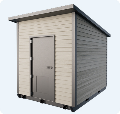
There is a narrower scenario the sequence doesn't cover. A wind-driven fire can move faster than a departure window, and a single access road can be cut by fire, a downed tree, or a wreck ahead of you. For that case, an engineered on-site refuge designed for wildfire conditions is one layer within a broader preparedness strategy. The FORT is an above-ground refuge built for exactly that scenario, and its performance is documented in independent testing.
An on-site refuge only works as a decision made months in advance. The distinction matters because sheltering in place during a wildfire, in an ordinary house, in a garage, in a vehicle, is not a plan and carries real risk. A refuge engineered for wildfire is a different thing from a room you retreat to when you've run out of options, and the difference is entirely in whether it was engineered and installed before the day, and rehearsed after.
The FORT doesn't change the monitor, prepare, evacuate sequence. It sits underneath it as the layer for the case where the third step becomes impossible, designed to work alongside evacuation planning and home hardening. A household with a refuge on the property still watches the forecast, still stages the car, still sets a go trigger, and still leaves early. The refuge exists for the afternoon when leaving early wasn't available. It also holds what the household didn't have room to carry out: once a Red Flag Warning is up, moving valuables inside it is part of the routine, whether or not the day ends in evacuation.
Frequently Asked Questions
Fire weather is the combination of weather conditions that let a wildfire ignite easily and spread fast: low relative humidity, strong wind, dry vegetation, and unstable air above the ground. Forecasters at the National Weather Service track all four and issue fire weather watches and warnings when they line up. The term wildfire weather means the same thing.
A Fire Weather Watch means critical fire weather conditions are possible during the watch window, typically a day or more ahead, while a Red Flag Warning means those conditions are occurring now or beginning shortly. A watch is the cue to review your plan; a warning is the cue to act on it. A watch may upgrade to a warning as the forecast becomes clearer, and either one can be issued without any fire burning nearby. The National Weather Service publishes the official definitions of both, and our guide covers how to prepare when one is issued.
There is no single national threshold, because each National Weather Service forecast office sets Red Flag criteria for its own fire weather zones based on local fuels, terrain, and climate. As one real example, a Red Flag Warning issued for the Klamath Basin fire weather zone in August 2026 cited wind of 15 to 20 mph with gusts to 25 to 30 and minimum humidity of 12 to 18 percent. Those are that zone's numbers on that day, and the figures for a coastal county could be considerably lower.
Santa Ana and Diablo winds are offshore wind events in which air descends from the interior toward the California coast, compressing and warming as it falls so that it arrives hot, dry, and fast. Santa Ana winds affect Southern California and are most common from autumn into winter; Diablo winds affect the San Francisco Bay Area and North Bay, where gusts can exceed 60 mph. Both produce the state's most dangerous fire weather, and both can blow hardest overnight rather than in the afternoon.
No. Staying home is not a safe substitute for leaving, and evacuation is always the safest option on a dangerous fire weather day. An ordinary house offers little protection against the radiant heat and ember exposure of a wind-driven wildfire, and staying puts you in a position where a blocked road removes your remaining choices. For the narrower case where evacuation becomes impossible, an engineered on-site refuge like the FORT is designed as one layer within a broader preparedness strategy, with performance documented in independent testing. It works alongside an evacuation plan rather than in place of one, and if you have it, a Red Flag Warning is the cue to move valuables inside it too, whether or not you end up leaving.
Key Takeaways
- Fire weather is wind plus dry air plus dry fuel, and drought sets how bad any given day can get.
- A Red Flag Warning is a weather alert, never an evacuation order.
- Red Flag criteria are set zone by zone, so only your own forecast office's numbers mean anything.
- Offshore wind days are the worst days, and they don't quiet down after dark.
- Embers travel a mile ahead of the fire, which is why the first 5 feet around the house matter most.
- ERC and FWI are agency planning tools; your local forecast and the Fire Weather Outlook are yours.
- Write your go trigger down before the day, then leave early.
Final Thoughts
Fire weather is the one part of wildfire risk that announces itself in advance. The fuel on your hillside took years to get that dry and the terrain isn't going to change, but the weather that turns both of those into an emergency shows up in a forecast several days out, with a name and a set of hours attached. That advance notice is the whole asset, and using it well is mostly a matter of having decided what you'll do before you need to decide.
So the work is unglamorous and it's front-loaded. Clear the first 5 feet. Screen the vents. Drive the second route. Write down what makes you go, and then go early when the day comes. For the households that want a layer covering the scenario where leaving early wasn't possible, the FORT is built for that narrow case, as one part of a plan that still puts evacuation first. If you have the FORT, let a Red Flag Warning be the same cue to move your valuables into it, whether or not the day ends with you driving away.